PIX4Dfields has become a real game changer that allows me to be in several places almost simultaneously and with the same precision I would have if I were physically at the intervention site.
Environmental Control Technician, DigitalAgro
Pix4D allowed us to process the information quickly and reliably, generating selective prescription maps that integrated seamlessly with the drone application. This was critical to achieving efficient control of Aleppo Sorghum and significantly reducing herbicide use.
Agricultural Engineer at Agropix Technological Solutions
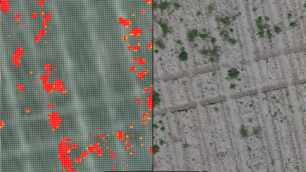
One of the key advantages of PIX4Dfields is the Magic Tool, which excels at detecting weeds in the field. It allowed us to quickly and accurately identify the areas infested with weeds, making it an invaluable tool for creating precise, targeted spraying maps. This functionality not only improved the efficiency of weed control but also contributed to significant cost savings and reduced environmental impact.
Digital Agriculture Specialist, responsible for drone flight and data acquisition, Wanicki Group


.jpeg?width=287&height=176&name=images%20(3).jpeg)


.jpg)
.png "Captura de pantalla 2026-04-24 a las 14.35.05 (2)")
.png?width=898&height=467&name=Captura%20de%20pantalla%202026-04-24%20a%20las%2014.35.05%20(2).png "Captura de pantalla 2026-04-24 a las 14.35.05 (2)")