PIX4Dcatch-logo-313x313

     Transform your work with precise 3D Scanning & AR Kit


    From data collection to deliverables in just a few clicks. With Pix4D’s smartphone-based 3D scanning workflow, your scanning kit captures survey-grade data faster than ever. Integrated Pix4D solutions ensure accurate models ready for AR, BIM, or analysis—delivered with speed, precision, and confidence.

    ESO Surveyors GeneralElectric_logo_1 Sony Logo veris-australia-logo-vector_1

    Advanced mapping and land surveying softwares.

    Mapping and land surveying with drone images, terrestrial LiDAR and photogrammetry

    Catch-Icon-Only-dark
    PIX4Dcatch

    Capture 3D scans with your smartphone – turn any space into a precise point cloud instantly.

    cloud-Icon-Only-dark
    PIX4Dcloud

    Process imagery in the cloud – deliver DSMs, orthomosaics, volumetric, and 3D textured meshes.

    Matic-Icon_only-Dark
    PIX4Dmatic

    GPU-accelerated photogrammetry – batch process drone & terrestrial imagery into orthomosaics.

    Survey-Icon-Only-dark
    PIX4Dsurvey 

    Mark your assets on PIX4Dsurvey as vectors in the point cloud and export them as DXF (for CAD) or SHP (for GIS).

    Geo-fusion: Where Reality Capture Meets 3D Modeling & AR

    Turn real-world captures into precise 3D models and AR experiences. Discover how Geo-fusion streamlines field capture, processing, and sharing—get the free PDF guide in your inbox.

    PIX4Dcatch Surveyors.se Landing

    High-precision GNSS hardware.

    Capture high-accuracy data using iOS and cloud RTK workflows with Emlid Reach RX and Pix4D Software solutions.

    Seamless cloud upload, automated processing, and accurate 3D models—all with advanced mobile scanning tools.

    preview-2-Coslada Madrid
    Pix4Dcatch_logo+1+(3)

    Capture Accurate Field Data

    Use the PIX4Dcatch app integrated with leading GNSS technology to collect high-precision, geotagged 3D data using with improved GeoFusion combining your smartphone sensors, LiDAR and camera. 

    PIX4Dcloud - PIX4Dmatic - Logos
    2. Process Your Data Seamlessly

    Upload your images to PIX4Dcloud for automatic photogrammetric processing, or use PIX4Dmatic on desktop to process images locally with advanced control. Combine terrestrial and drone datasets with ease.

    Pix4Dmatic logo + PIX4Dsurvey logo
     3. Scale Up Accuracy, Cut Processing Time

    Easily extract deliverables in GIS, CAD, or BIM formats using PIX4Dsurvey. Annotate your point cloud, mark assets as vectors, and export to DXF (CAD) or SHP (GIS) — ready for integration into your preferred design or mapping software.


    Share. Review. Deliver. Instantly.

    PIX4Dcloud turns scans into 3D models you can share with a link—no installs, no delays, just insights.

    Kit-de-Escaner-PIX4D-EMLID

    Trusted by Professionals. Engineered by Experts.

    Pix4D is a market leader in photogrammetry and 3D scanning, offering end-to-end solutions that turn images from drones, phones, or any camera into survey-grade models and actionable insights. Built on Swiss R&D, our ecosystem ensures accuracy, scalability, and seamless collaboration from field to cloud.

    Trusted by Experts Across Industries

    Professionals trust Pix4D to deliver reliable, survey-grade results. Read how they use our solutions to enhance field capture, processing, and data sharing.

    igor 120x120
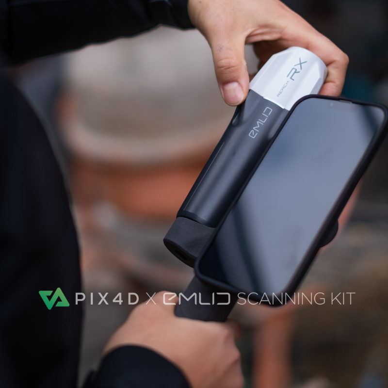
    Scanning with PIX4Dcatch and RTK is just like taking avideo, there is nothing more to do. You press a buttonand it starts to scan. For trench scanning anddocumentation, this could be given to anyone with fiveminutes of explanation and they will be good to go.
    Igor Vereninov
    Co-Founder and CEOat Emlid
    Larry 120x120
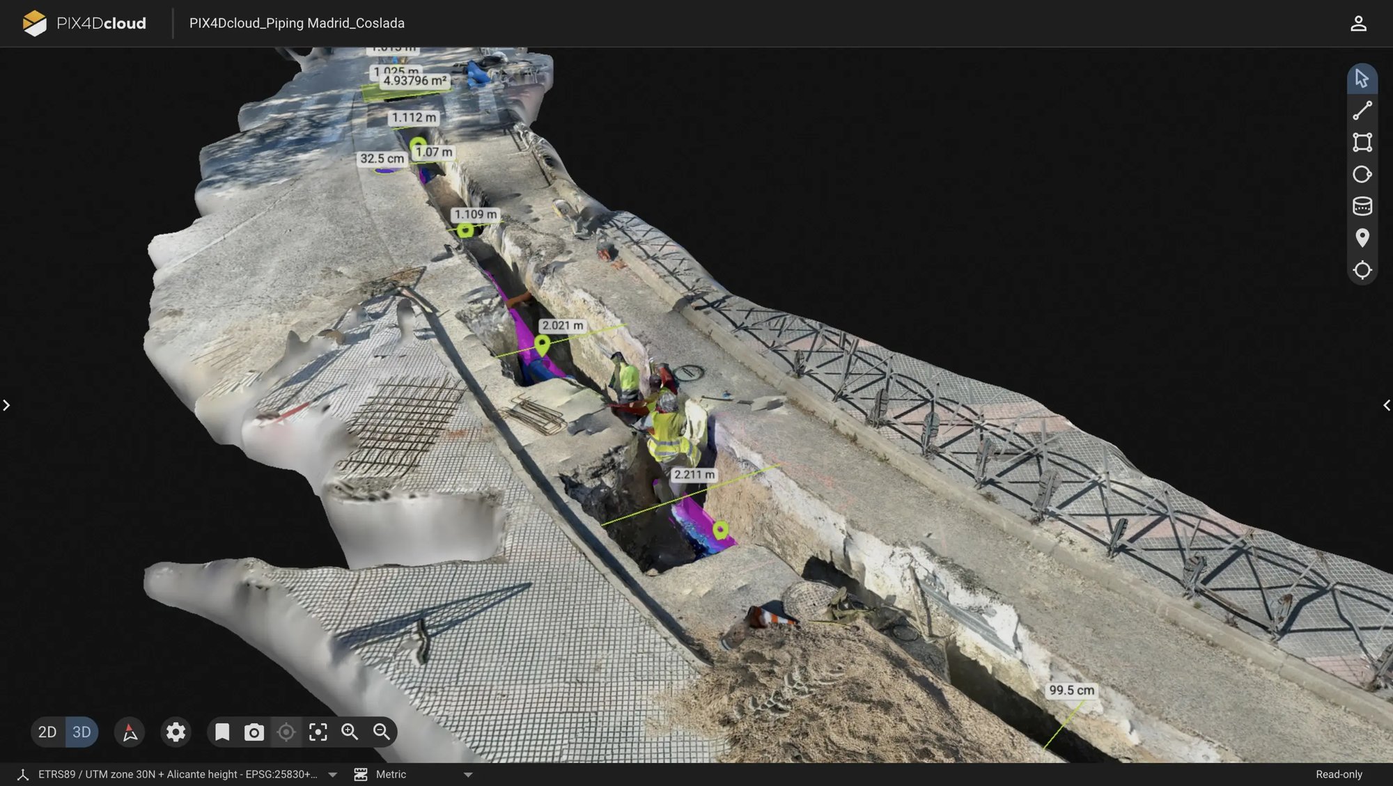
    You can turn your smartphone into an AR scanner that maps buried utilities with centimeter-level accuracy—visualize pipes below ground, store an interactive 3D model in the cloud, eliminate paper errors, and empower planners to make data-driven decisions for years to come.
    Larry Fox
    VP of Marketing and Business Developmentat Bad Elf
    Shane Shi 120x120
    The combination of PIX4Dcatch with RTK and PIX4Dcloud has enabled us to create high-quality 3D scans that are geospatially accurate and easy to share with stakeholders. Not only is the workflow intuitive and seamless, but it is also at a fraction of the cost of other multi-part solutions available on the market.
    Mr. Shane Shi
    Managing Director at HSC Pipeline

    Start your Free Trial!

    Sign up to unlock your free Pix4D trial — the fastest way to experience our industry-leading photogrammetry tools.